
English
Paperback
₹4195
(All inclusive*)
Delivery Options
Please enter pincode to check delivery time.
*COD & Shipping Charges may apply on certain items.
Review final details at checkout.
Looking to place a bulk order? SUBMIT DETAILS

Piracy-free

Assured Quality

Secure Transactions
About The Book
Description
Author
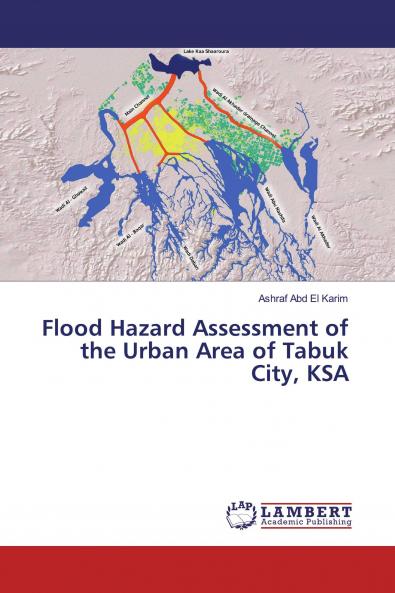
This book deals with the use of remote sensing (RS) geographic information systems (GISs) hydrologic modeling (water modeling system WMS) and hydraulic modeling (Hydrologic Engineering Center River Analysis System HEC-RAS) to evaluate the impact of flash flood hazards on the sustainable urban development of Tabuk City (KSA). Determining the impact of flood hazards on the urban area and developing alternatives for protection and prevention measures were the main aims of this work. WMS and HEC-HMS models and RS data were used to determine the paths and morphological characteristics of the wadis the hydrographic flow of different drainage basins flow rates and volumes Finally hydraulic modeling of the HEC-RAS program was applied to delineate the urban areas that could be inundated with floodwater. Ultimately the most suitable remedial measures are proposed to protect the future sustainable urban development of Tabuk City from flood hazards. This approach is rarely used in the KSA. We propose a novel method that could help decision-makers and planners in determining inundated flood zones before planning future urban development in the KSA.
Piracy-free
Assured Quality
Secure Transactions
Delivery Options
Please enter pincode to check delivery time.
*COD & Shipping Charges may apply on certain items.
Review final details at checkout.
Details
ISBN 13
9786139472352
Publication Date
-28-03-2019
Pages
-52
Weight
-81 grams
Dimensions
-150x220x3.27 mm
