
English
Paperback
₹3654
₹3847
5.02% OFF
(All inclusive*)
Delivery Options
Please enter pincode to check delivery time.
*COD & Shipping Charges may apply on certain items.
Review final details at checkout.
Looking to place a bulk order? SUBMIT DETAILS

Piracy-free

Assured Quality

Secure Transactions
About The Book
Description
Author
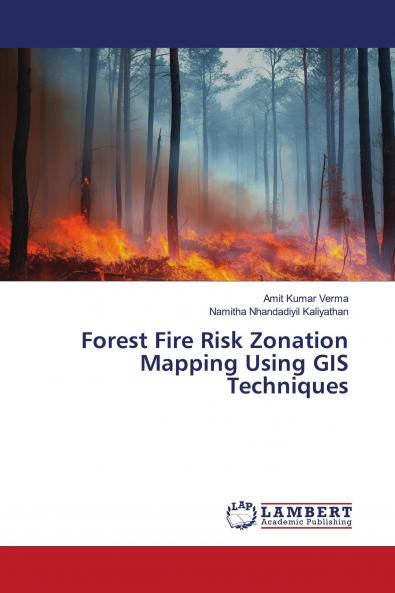
In this book we have provided information on how to identify forest fire risk zones by analyzing historical fire incidences along with influencive biophysical parameters responsible for forest fire for a particular landscape using GIS techniques. Forest fire risk zones were delineated by assigning subjective weights to the classes of all the parameters according to their sensitivity to fire or their fire-inducing capability. Two categories of fire sensitive regions such as most sensitive and sensitive fire intensity zones were identified. The result shows that almost 20% of the study area was predicted to be under most sensitive. The evolved GIS-based forest fire risk model of the study area was found to be in strong agreement with actual fire-affected sites. Such study can help in preparing base map for preparatory planning for forest fire management for a particular area.
Piracy-free
Assured Quality
Secure Transactions
Delivery Options
Please enter pincode to check delivery time.
*COD & Shipping Charges may apply on certain items.
Review final details at checkout.
Details
ISBN 13
9786206150503
Publication Date
-13-06-2023
Pages
-88
Weight
-126 grams
Dimensions
-150x220x5.12 mm
