

English


Paperback
₹3506
(All inclusive*)
Delivery Options
Please enter pincode to check delivery time.
*COD & Shipping Charges may apply on certain items.
Review final details at checkout.
Looking to place a bulk order? SUBMIT DETAILS

Piracy-free

Assured Quality

Secure Transactions
About The Book
Description
Author
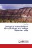
In the earlier time Rajasthan State is known as Rajputana and came into existence on March 30 1949. It covered 342239 sq km area and occupied 10.74% of the Indian Territory. It is also the largest State in India. The Rajasthan State is located within 23o03'-30o12'N and 69o29'-78o17'E. It is confined to the west and northwest by Pakistan on the north and northeast by Haryana and Uttar Pradesh and the south-southeast and southwest by Madhya Pradesh and the Gujarat States respectively. The state is covered by the Thar Desert in North West direction and covers 32% area of the total area. The Aravalli hill ranges are extending from Delhi in the northeast to the plains of north Gujarat in the southwest and physiographical divides the State into two uneven parts. The area to the east of the hills covered by the eastern plains and the Vindhyan plateau. In the present geological visit we have explored several Geological fascinating places which including Khetri copper complex HCL Khertinagar where we have visited underground mine and studied about the Mine operations copper ore bodies and Geology of this area which comes under Delhi super group.
Piracy-free
Assured Quality
Secure Transactions
Delivery Options
Please enter pincode to check delivery time.
*COD & Shipping Charges may apply on certain items.
Review final details at checkout.
Details
ISBN 13
9786139844883
Publication Date
-28-05-2018
Pages
-60
Weight
-95 grams
Dimensions
-150x220x3.68 mm
