
English
Paperback
₹221
₹299
26.09% OFF
(All inclusive*)
Delivery Options
Please enter pincode to check delivery time.
*COD & Shipping Charges may apply on certain items.
Review final details at checkout.
Looking to place a bulk order? SUBMIT DETAILS

Piracy-free

Assured Quality

Secure Transactions
About The Book
Description
Author
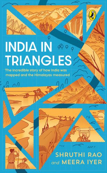
Step into the boots of fearless surveyors as they trek across forests mountains and monsoonsfacing disease wild animals and gruelling terrainto chart the subcontinent with astonishing precision.This was the Great Trigonometrical Survey an ambitious mission to map India using triangulationa brilliant method that helped them measure every inch with accuracy. Along the way they calculated the height of the worlds tallest mountain and revealed the true shape of the earth.Packed with adventure ingenuity mishaps and the unsung heroes of science this is the epic true story of mathematics grit and discovery.
Piracy-free
Assured Quality
Secure Transactions
Delivery Options
Please enter pincode to check delivery time.
*COD & Shipping Charges may apply on certain items.
Review final details at checkout.
Details
ISBN 13
9780143468387
Publication Date
-09-07-2025
Pages
-144
Weight
-124 grams
Dimensions
-135x216x9.02 mm
