English


Paperback
₹1958
(All inclusive*)
Delivery Options
Please enter pincode to check delivery time.
*COD & Shipping Charges may apply on certain items.
Review final details at checkout.
Looking to place a bulk order? SUBMIT DETAILS

Piracy-free

Assured Quality

Secure Transactions
About The Book
Description
Author(s)
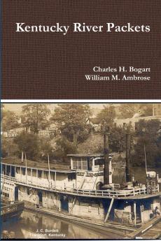
The Kentucky River is formed in eastern Kentucky at Beattyville where the North Middle and South Forks join together. The river then flows 260 miles to the Ohio River at Carrolton. The river drains much of the central region of the state. With the appearance of the early steamboats on the Kentucky River in the 1820s the river became the primary artery for economic growth with trade with the lower south. This dominance lasted until the Civil War when the railroads surpassed the packetboats with freight traffic. After the war river traffic shifted to towboats pushing barges of bulk commodities. However steam packetboats and later gasboats continued to service the isolated river communities along the lower river until the Great Depression. In 1836-1842 the Commonwealth of Kentucky constructed five locks and dams from Carrollton to Tyrone. These dams created pools of water which allowed year round slackwater navigation. The state operated these locks until after the Civil War.
Piracy-free
Assured Quality
Secure Transactions
Delivery Options
Please enter pincode to check delivery time.
*COD & Shipping Charges may apply on certain items.
Review final details at checkout.
Details
ISBN 13
9780359051908
Publication Date
-27-08-2018
Pages
-238
Weight
-328 grams
Dimensions
-152x229x13.74 mm
