
English

Paperback
₹5772
(All inclusive*)
Delivery Options
Please enter pincode to check delivery time.
*COD & Shipping Charges may apply on certain items.
Review final details at checkout.
Looking to place a bulk order? SUBMIT DETAILS

Piracy-free

Assured Quality

Secure Transactions
About The Book
Description
Author
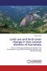
This book maps the Land Use and Land Cover change in two coastal districts of Karnataka viz. Udupi and Dakshina Kannada using Remote Sensing and Geo Information System techniques. Multi-spectral scanner images from the Landsat Satellites during the period from 1973 to 2000 were chosen as the study images. The book looks into the impact of the Land Use and Land Cover Change drivers of the change and the correlation between the drivers and the impacts. A prediction is also made for the expected Land Use and Land Cover in the year 2020 if the current trend continues. Finally an effort is made to suggest ways of sustainable land management and also recommend appropriate locations for the upcoming SEZs in the area.
Piracy-free
Assured Quality
Secure Transactions
Delivery Options
Please enter pincode to check delivery time.
*COD & Shipping Charges may apply on certain items.
Review final details at checkout.
Details
ISBN 13
9783659890468
Publication Date
-22-06-2016
Pages
-116
Weight
-161 grams
Dimensions
-150x220x6.56 mm
