

This Book is Out of Stock!
English


Paperback
₹3890
(All inclusive*)
Delivery Options
*COD & Shipping Charges may apply on certain items.
Review final details at checkout.
Looking to place a bulk order? SUBMIT DETAILS
*COD & Shipping Charges may apply on certain items.
Review final details at checkout.
About The Book
Description
Author
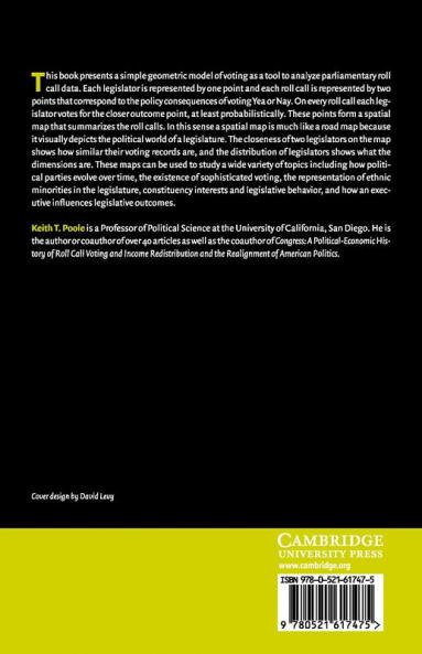
This book presents a simple geometric model of voting as a tool to analyze parliamentary roll call data. Each legislator is represented by one point and each roll call is represented by two points that correspond to the policy consequences of voting Yea or Nay. On every roll call each legislator votes for the closer outcome point at least probabilistically. These points form a spatial map that summarizes the roll calls. In this sense a spatial map is much like a road map because it visually depicts the political world of a legislature. The closeness of two legislators on the map shows how similar their voting records are and the distribution of legislators shows what the dimensions are. These maps can be used to study a wide variety of topics including how political parties evolve over time the existence of sophisticated voting and how an executive influences legislative outcomes.

Piracy-free

Assured Quality

Secure Transactions
₹3890
Out Of Stock
All inclusive*
Details
ISBN 13
9780521617475
Publication Date
-16-06-2005
Pages
-250
Weight
-344 grams
Dimensions
-152.4x228.6x13.44 mm
