


English



Paperback
₹4184
₹5390
22.37% OFF
(All inclusive*)
Delivery Options
Please enter pincode to check delivery time.
*COD & Shipping Charges may apply on certain items.
Review final details at checkout.
Looking to place a bulk order? SUBMIT DETAILS

Piracy-free

Assured Quality

Secure Transactions
About The Book
Description
Author
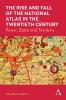
<p>Between 1900 and 2000 more than seventy countries produced a national atlas an official or quasi-official rendering of the nation-state in maps and accompanying text. This book considers the reasons behind and characteristics of this state-sponsored cartographic explosion. These national atlases mirror and embody some of the important themes of this turbulent century including the complex connections between nation state and territory the rise of state-sponsored science; the growth of nation-states; colonialism and postcolonialism; and the geography of biopolitics.</p>
Piracy-free
Assured Quality
Secure Transactions
Delivery Options
Please enter pincode to check delivery time.
*COD & Shipping Charges may apply on certain items.
Review final details at checkout.
Details
ISBN 13
9781839992476
Publication Date
-16-04-2024
Pages
-182
Weight
-255 grams
Dimensions
-152x229x9.84 mm
